Party: Mountaineers - Leader: Linda Sheehan , Rope Leaders: Chad Miller and I. Basic Students: Barry Brumitt, Evelyn ?, Britt Murphy, Kimberly ? and one other student (John?)..
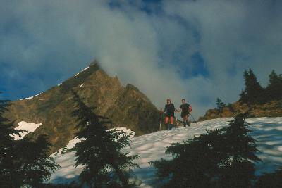
Weather: Overcast, foggy weather for the entire ascent. Of course, it cleared up and became sunny when we were down the west ridge.
Ok, we screwed up on the approach. An executive decision by Chad and I over-ruled the instincts of our leader on picking a certain logging road turn-off. In the approach description, where it is described as turning left onto a logging spur with a large dead tree beside the road..... really there is a large dead tree beside the road. And a second downed log shortly up this clear road. We took an over-grown, obscure road that had a few dead snags "near" its entrance..... as an after thought, these clearly don't count as "large dead trees laying by the road entrance"! Further more, the lack of indications of foot traffic on this road should have turned us back sooner. We justified the lack of scruffed up dirt to recent heavy rains. Needless to say, we ascended these logging roads to an end. at which point a flagged trail... fitting the description as a "thin trail" through the clear cut, quickly disappeared! We bush-wacked through clear-cut scrub brush for a LONG while. We got wet, cut to shreds and tired. Eventually, we came out of the woods onto a well used trail... THE Trail. From where we found the trail, it was a short hike to what begins to feel like the west ridge scramble.
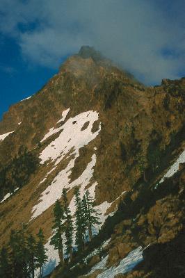
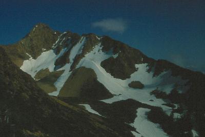
The rest of the climb is just a lot of fun. I have trouble identifying the way we went with anything that is described in Becky's guide. The crux in Becky's guide is implied to be a choice between a class 4 chimney or a class 3 climb with "bucket holds". I guess, I need to understand what Becky means by either a chimney or bucket holds. We went up a few gulleys that could be described as chimneys, and we also climbed some short sections that definitely had large holds along a broken, cracked face.
Either way, I think the Becky description tends to overstate the difficulty
of this climb. Maybe I just haven't experienced enough scrambling to be
able to distinguish between class 3 and 4. In my opinion, I didn't experience
any class 4 areas (no areas I felt the need to rope up on).
On the way down, I expected that we would have to rappel the pitch near the thin gable. We started preparing for the rappel when Chad and I found different, easier ways to down climb from the gable. My path involved walking along the gable and then down climbing along a ledgey traverse on the left (W) hand side of the gable. Chad went down around the right (E) side of the gable. Given that Chads path was less exposed, and the consequences of a fall were not as serious, Linda advised the students to go Chad's way. I think the down climbing was more difficult, but safer.
We left the summit at 3:30 and were down at the trail and the base of the ridge around 7:30.... four hours to descend the west ridge! Another 2 hours were required to get back to the trailhead.... along the grueling roads.
This is an awesome scramble.... did I say that already? I wish we had better weather and a view on the way up. It probably would have sped the ascent as well if we could see the route ahead of us. Anyway, I will surely come back to do this again, probably as a traverse between the North and South Twins. A team of fast, competent climbers who don't get lost on the approach and bring mountain bikes should be able to complete this climb from car-to-car in about 6 hours..... we took 14.5.... I'm getting used to these basic climb epics! :)